 Dear Wise Earth · Costa Rica
Land Report
Santa Elena, Monteverde
144.5 hectares, read from the satellite and climate archives and the public record.
Prepared by Dear Wise Earth
Contents
Read on 12 June 2026, 127 days before this issue. Every figure names its source and the period it covers. Figures from a closer study of this land are marked where they appear.
- ·Executive summaryThe verdict, the findings, what changed, what to watch and what to do
- 1Introduction and methodologyPurpose, scope, how the report is made, dates and limits
- 2The land at a glanceIts particulars and the figures that define it
- 3ObservationsWhat the record shows, each figure with the period it covers
- 4Changes since the last reportWhat moved since the land was last read
- 5What to watchThe risks to follow and the signs that call for attention
- 6RecommendationsThe work, in the order it should be done
- 7ConclusionThe reading in brief, signed by Dear Wise Earth
- ASources and notesEach source named and dated
- BPhoto creditsThe photographs, their authors and their licences
Executive summary
Good bones. The rest is work.
Floor, 40Short of the floorTree cover, 94.7%
Key findings
Since the last report
This is the first report on this land: it is the baseline for every later one.
What to watch
- Most of the parcel reads as tree cover.
- No satellite soil data is available for this parcel.
Recommendations, in order
| # | Recommendation | How to confirm | When |
|---|---|---|---|
| 1 | Ground-truth what the canopy actually is before assuming forest value. | Inspect the stand on site: one species in rows is plantation; mixed ages and species with natural regeneration is forest. A botanist can confirm. | First visit |
| 2 | Commission a ground soil survey before any agricultural or restoration decision. | Take samples across the parcel for a lab test of organic carbon, texture, and pH, and dig a pit to read the profile and rooting depth. | Before committing |
| 3 | Scope the regenerative work on a site visit before committing capital. | Read the water, soil, and cover on the ground, then plan the work from the most permanent layer down. | First visit |
Introduction and methodology
How this report was made
This report sets out what the public record shows about Santa Elena, Monteverde: its water, ground, forest, life, climate, and the rules and people around it, and what each of these means for a decision about the land. It is written for owners, buyers, investors and stewards who need the evidence in one place before they commit time or money.
The land inside the boundary supplied, 144.5 hectares in Santa Elena, Monteverde, Puntarenas Province, and the country around it wherever a figure depends on it, such as a watershed, a corridor or the regional climate. Legal title, permits, valuation and the condition of any buildings are outside its scope.
The report is produced by TERRA, Dear Wise Earth's land-reading engine. TERRA asked 8 public sources about the boundary: satellite imagery, elevation and soil maps, climate archives and projections, biodiversity records, and protected-area and land-use registers. 7 answered for this land. Each figure is computed from its source, never estimated by hand. Where a source was silent, the pillars it feeds were reweighted, not guessed, and the silence is stated.
Five pillars are scored from 0 to 100: water, ecology, climate resilience, freedom from pressure and soil. Forty is the fair floor: a pillar below it needs attention before the land is relied on. The pillars combine into one score and one of four verdicts: Anchor (75 and above), Restore (55 to 74), Cultivate (35 to 54) and Reclaim (below 35).
The record read for this land runs from 1984 to 12 June 2026, the date of the reading. Each figure in section 3 carries the period it covers, and every source is listed with its date in Appendix A. This report was issued on 18 October 2026.
Each finding says how sure it is, with three bars and a word. Measured (three bars): read directly by an instrument, or agreed by two independent records. Modelled (two bars): measured at a coarse scale, or worked out from good data. To confirm (one bar): inferred from other records, and only a site visit or a sample can settle it.
The report reads the land from orbit and from public records. It does not replace a site visit, a soil test, a title search or professional advice, and it states what the record cannot see. On a parcel under one hectare the figures describe the ground around it.
Dear Wise Earth issues this report so that a decision about land can rest on evidence. Findings are reported as observed, favourable or not, and each one names its source.
The land at a glance
Santa Elena, Monteverde
Particulars
Boundary
N 10.30541 N · S 10.29459 N
W 84.80549 W · E 84.79451 W
Centre 10.300 N, 84.800 W
Observations
Observations
What the record shows about the land, part by part. Each figure carries the period it covers; each finding, how sure it is.
- 3.1The land from aboveEvery picture of it from orbit
- 3.2Water and groundRain, where it goes, slope, soil and what the ground has done
- 3.3Forest and lifeThe canopy and its record, its rhythm, and the species recorded on it
- 3.4Climate and airNow, around 2050, and the air it breathes
- 3.5Place, rules and fitPeople, reach, the rules that touch it, what it is suited to
Three ways of seeing the same ground
The same ground three times at one scale, north up: the photograph, its form, and what grows on it.
From above, in numbers
What watches it from above, and how finely
Each instrument reads the land in cells of its own size. The squares are drawn at true scale against the land: the finer the cell, the more of the land's detail it holds.
| Instrument | Cell | How often |
|---|---|---|
| Sentinel-2 · The land in colour and infrared | 10 m | Every 5 days |
| ESA WorldCover · What covers the ground | 10 m | Once, 2021 |
| Hansen Global Forest Change · Tree cover, and where it was lost | 30 m | Every year since 2001 |
| AWS Terrain Tiles · The shape of the ground | 30 m | Once |
| NASA FIRMS · Fire | 375 m | Several times a day |
| CHIRPS · Rain | 5.5 km | Every day since 1981 |
| Open-Meteo · Temperature, wind, the climate ahead | 9 km | Every hour |
Rain · the last 21 years
Río Peñas Blancas crosses it
55 watercourses are traced on and around the land, among them Río Peñas Blancas, Río San Luis, Quebrada Camastro. No standing water shows on it in the 1984 to 2021 record. Water here moves; it does not sit.
Its years
The driest year was 2012, with 1,957 mm. The wettest, 2024, had 3,899 mm. The last ten years averaged 2,775 mm, against 2,895 mm in the first ten.
Rain each year, mm, 2004 to 2024. Read on a grid about 9 km across.
Terrain
1,513 m above the sea
The land rises 198 m, from 1,403 m to 1,601 m, around a mean of 1,513 m.
Height
Lowest to highest point on the land, metres above sea level.
Soil
Silent. No soil record answered for this land. Soil is a ground survey: organic carbon, texture and pH across the land, and one pit to read the profile.
Cover · mapped in 10-metre squares
Land under canopy
Grassland covers 4.6% and buildings 0.7%.
What covers it
Share of the land by what covers it.
Since 2017
Year against year
Compared with how it read in 2017, the ground in 2025 is 0.965 alike on a scale where 1.00 is the same land and 0.80 marks change. 0% of the land crossed that line.
Forest or plantation
The cover map reads tree cover. It cannot tell a natural forest from rows of a single species, and the difference decides the land's conservation and carbon value. It is the first thing to settle on a visit.
The land's rhythm
0.3 ha of forest opened here after 2020. This is its record.
243 clear looks279 looks through cloud0.3 ha of forest opened after 2020
- 81%
- holds steady through the year
- 3%
- follows the seasons
- 16%
- moves without a regular pattern
- Steady
- the land keeps the same green, wet season and dry
- 0.3 ha
- of forest opened after 31 Dec 2020
- Level
- no lasting gain or loss of green since 2018
This land keeps no growing season to plan by. Between its lowest and highest month its usual green moves by 0.03, on a scale where bare ground reads near 0 and dense forest near 0.9, dry months included.
Records inside the boundary
A well-watched place
A count says how closely a place is watched as much as how rich it is. Lampornis calolaemus leads with 9,020 records.
Who leads the record
Records of each species inside the boundary, the top 5.
The corridor
The land lies inside the Corredor Biológico Pájaro Campana, in the Área de Conservación Arenal-Tempisque (ACAT). An altitudinal corridor carrying the three-wattled bellbird's migration from the Monteverde cloud forest down to the Gulf of Nicoya mangroves.
The corridor's extent is a screening line; confirm the land against the national record.
Life photographed around the land
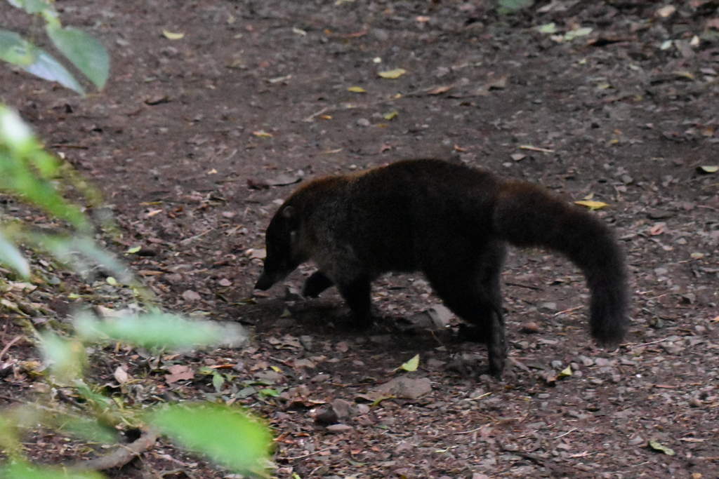
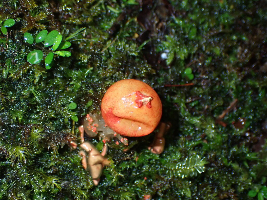
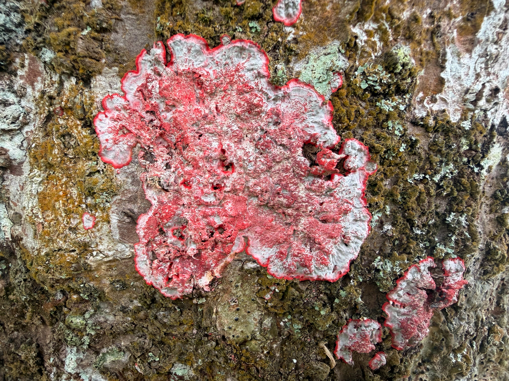
Each photograph is an open observation made around the land, within the distance shown, credited beneath it: animals, plants and fungi, wherever the record holds them. Photographs taken on this land will replace them.
Now · and the late 2040s, expected
Warmer, and a little drier
Mean heat today is 17.9 °C. The futures read for it rise by +1.5 °C. Rain changes by −3%.
The range of futures
The bars span the futures read for this land. Warmer is certain; how much wetter or drier is open.
At a glance
The year in rain
A dry season of two months, February to March
The rains peak in October at 476 mm; the year brings 2,796 mm on average. The dry months bring 52 mm between them: what the land keeps from the wet months carries it through.
The amber line marks 50 mm: under it a month is dry, and drawn open. Mean rain in each month, CHIRPS v3, 2004 to 2024.
People · reach · rules
Inside a national corridor
Who lives around this land did not answer on this reading.
How far
Straight-line distance from the land, on a log scale so near and far both read.
Rules and records
What this land is for
Where the parcel sits between securing it and hosting people on it, and the project that fits it best.
Best-fit model
Guard the headwaters; study what they hold.
High-value corridor land to secure before it is lost.
Changes since the last report
What changed since the land was last read
This is the first report issued for this land. It sets the baseline: every later report is set against it, pillar by pillar.
What the next report will set against this one
| Measure | This reading | Next reading |
|---|---|---|
| Score | 72 | at the next reading |
| Verdict | Restore | at the next reading |
| Water | 98 | at the next reading |
| Ecology | 77 | at the next reading |
| Climate | 69 | at the next reading |
| Pressure | 46 | at the next reading |
| Soil | not read | at the next reading |
TERRA Watch on this land
TERRA Watch is not on for this land yet.
Once on for this land, it looks at every clear satellite pass, tells you the same day a sign you watch for crosses its line, and writes a short note each month. $19 a month per land · Free during launch · Cancel anytime.
How the watch works
The next twelve months, as the watch will see them
a satellite pass, every five daysa note from TERRA Watchthis report
Expected, not yet observed. Clouds hide some passes; an alert comes the day its sign crosses the line.
What to watch
What to watch on this land
Risks the reading found
Signs to monitor, and the instrument that sees each
| Sign | What calls for attention | Instrument |
|---|---|---|
| Floods and heavy rain | River flow and rain, every day | GloFAS river flow and Open-Meteo rain |
| Dry spells and a low river | Rain against the last ten years, and the river's low water | ERA5 rain and GloFAS river flow |
| Fire within 2 km | Live alerts | NASA FIRMS (VIIRS) |
| Fire weather | Hot, dry, windy days, three days ahead | MET Norway forecast (fire weather index) |
| Gales | Wind of 62 km/h or more, forecast | MET Norway forecast |
| Dangerous heat | 35 °C or more, forecast | MET Norway forecast |
| Smoke, dust and air quality | The air quality forecast, four days ahead | CAMS air quality (Copernicus) |
| Earthquakes | Magnitude 5 or more within 100 km | USGS earthquake catalogue |
| Tropical storms | Storms tracked within 600 km | NOAA National Hurricane Center |
Once on for this land, TERRA Watch checks each of these every day and reports at once when one crosses its line.
Recommendations
Recommendations, in the order they should be done
Open questions
- Standing under the canopy, is it one species or many, and which parts would you protect rather than replant?
- Are you here to hold this land as it is, to work it, or to help it change, and does the reading above serve that intention?
- If the work succeeds, what do the water, the canopy, and the people around this land look like a generation from now, and what is the first condition that has to change for that to begin?
- Where does this reading disagree with what you have seen on the land? That disagreement is the first thing to check on the ground.
What the record cannot yet say
- The yearly rain is read on a grid about 9 km across. A ridge or a valley can be wetter or drier than its cell.
- Springs, wells and water rights are not on the record. They are a question for the land and its registry.
- Heights come from an elevation surface of about 10 m. A cut, a road or a slip since it was made is not in it.
- Earthquakes are counted around the land, not felt at it. Shaking depends on the ground under each building.
- The cover map dates from 2021. A field cleared or planted since then still reads as it was.
- Year against year is read in coarse squares. A clearing smaller than a square may not show.
- Canopy height and the carbon held in the trees did not answer on this reading.
- Records follow people. Trails, lodges and reserves draw observers, so the count measures attention as well as life.
- Which species are protected by law, and which breed on the land, are not separated in this count.
- The futures are read on a grid about 9 km across. Hills and valleys run cooler or warmer than their cell.
- Mist, cloud and wind are in none of the records, and on some land they matter more than rain.
- The hour-by-hour air is read for the region, a few kilometres across. A fire next door shows on a sensor long before it shows here.
- Fine particles only. Ozone, gases and pollen are not read yet.
- Three months back is one season. A whole year needs a sensor on the land.
- Population is a modelled estimate in 100-metre squares, not a census.
- Distances are straight lines. The road may run twice as far.
- Who owns and uses the land, and what its neighbours remember of it, is on no record here.
Fill the gaps on the ground
Satellites cannot read everything. These are the measures that would settle what this reading leaves open, the tools for each, and how to send them back to the land's record.
| What is open | What to measure | Tools | How |
|---|---|---|---|
| The soil | Organic carbon, texture, pH, depth to rock | A soil auger or spade, ten sample bags, a phone with GPS, an accredited soil lab | Take ten cores spread across the land and dig one pit 60 cm deep; photograph each layer beside a tape; send the bags to the lab. |
| The canopy | Natural forest or plantation; species, ages, young trees coming up | A 20 m tape, a phone with iNaturalist, a notebook | Mark three plots of 20 by 20 m; list the species, count the stems, photograph the canopy straight up from the centre. |
| The water | Springs and their flow at the end of the dry season; water quality | A bucket of known volume, a stopwatch, a phone with GPS, a simple water test kit | Time the bucket filling at each spring and stream crossing; mark each point; repeat in the driest month. |
| The life on it | Which animals use the land, and when | Two or three camera traps, a phone with iNaturalist | Leave the cameras a month on paths and water; upload the observations with their places. |
| The boundary | The corners on the ground against the registered plan | A phone with GPS, the land's registered plan | Stand at each corner, record its position, and photograph the marker if there is one. |
When the results are ready, scan the code and add the files to the land's record: PDF, photographs, spreadsheets, maps. TERRA reads them, and the next report uses them.
Conclusion
Conclusion
On the evidence observed for this report, Santa Elena, Monteverde scores 72 out of 100 and reads as Restore.
Three findings weigh most. Most of the parcel reads as tree cover. A watercourse runs through the parcel. Models project a warmer and drier climate here by 2050.
The first step: Ground-truth what the canopy actually is before assuming forest value.
Dear Wise Earth issues a new report each time the land is read again, and sets it against this one.
Appendix A · Sources and notes
Each source is named with the period it represents. 7 of 8 answered for this reading; a source that did not answer is said to be silent, and the pillars it feeds were reweighted, not guessed.
| Source | Period | Detail | Licence |
|---|---|---|---|
| Place, OpenStreetMap / Nominatim | live | settlement | ODbL 1.0 |
| Terrain, AWS Terrarium (Mapzen) | 2017 | ~10 m (z12) | Open (attribution) |
| Climate, Open-Meteo | 2004 to 2024 / 2045 to 2049 | ~9 km | CC-BY 4.0 (data); non-commercial API tier |
| Rainfall, CHIRPS v3 | 2004 to 2024 | ~5.5 km (0.05°) | CC BY 4.0 (doi:10.15780/G2JQ0P) |
| Land cover, ESA WorldCover | 2021 | 10 m | CC-BY 4.0 (commercial promotion: notify due@esa.int) |
| Water, roads & protected areas, OpenStreetMap | live | vector | ODbL 1.0 |
| Biodiversity, GBIF | live | point | Mixed CC0 / CC-BY / CC-BY-NC (per dataset) |
| Surface water, JRC Global Surface Water | 1984 to 2021 | 30 m | Copernicus / open (attribution) |
How sure each figure is: measured, read directly or agreed by independent records; modelled, measured at a coarse scale or worked out from good data; to confirm, inferred, to be settled on the ground. TERRA reads public satellite and open data and interprets it: a starting point for diligence and design, not a substitute for a site visit. Generated 12 June 2026.
Appendix B · Photo credits
The photographs of species are illustrative: research-grade observations from the global biodiversity archive, shared by their photographers under licences that allow this use. Photographs taken on this land replace them after the first site visit.
| Species | Author | Licence | Source |
|---|---|---|---|
| White-nosed Coati · Nasua narica | marmottled | CC BY 4.0 | www.gbif.org/occurrence/6130762510 |
| Stalked puffball-in-aspic · Calostoma cinnabarinum | Randal | CC0 | www.gbif.org/occurrence/6479908704 |
| Christmas lichen · Herpothallon rubrocinctum | Pat Hall | CC BY 4.0 | www.gbif.org/occurrence/6159560454 |

Read the land.Decide on the evidence.
dearwise.earth · read.dearwise.earth · connect@dearwise.earth